Hervey Bay History
When Captain James Cook rounded Sandy Cape in 1770 and found what is now Fraser Island, he initially concluded it was part of the mainland.
Cook named the area “Hervey’s Bay” after Augustus Hervey, at that time Britain’s First Lord of the Admiralty. In 1802 Matthew Flinders landed at Sandy Cape and drew detailed maps of the bay.
Indigenous Australians have inhabited the area for generations., From 1850, newly arrived immigrants from England acquired vast tracts of country for cattle rearing between Booral and Burrum Heads. Pines growing along the foreshore attracted timber cutters in 1863 and by the mid 1860s the first five white settlers took possession of seaside leases stretching from Point Vernon to Urangan. Each of the land leases developed into small townships, with seaside lots being bought up by wealthy businessmen from Maryborough and Gympie.
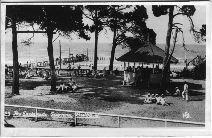
Boyle Martin, acknowledged as the first white settler in the bay, took up land at Pialba, which soon became a small but thriving seaside resort. Although Torquay , named after the English seaside resort in Devon and Scarness, named after a town in Cumbria (UK), also grew rapidly, the whole area at that time was known as Pialba.
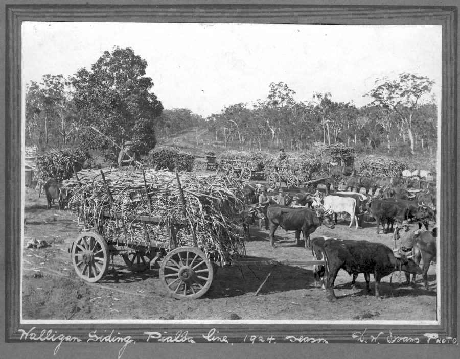
Coal mining was started at Howard in 1863 and limestone, bismuth, magnetite and mineral sands were also mined. In 1883 two sugar juice mills opened in Hervey Bay and the population of Pialba swelled to 85.
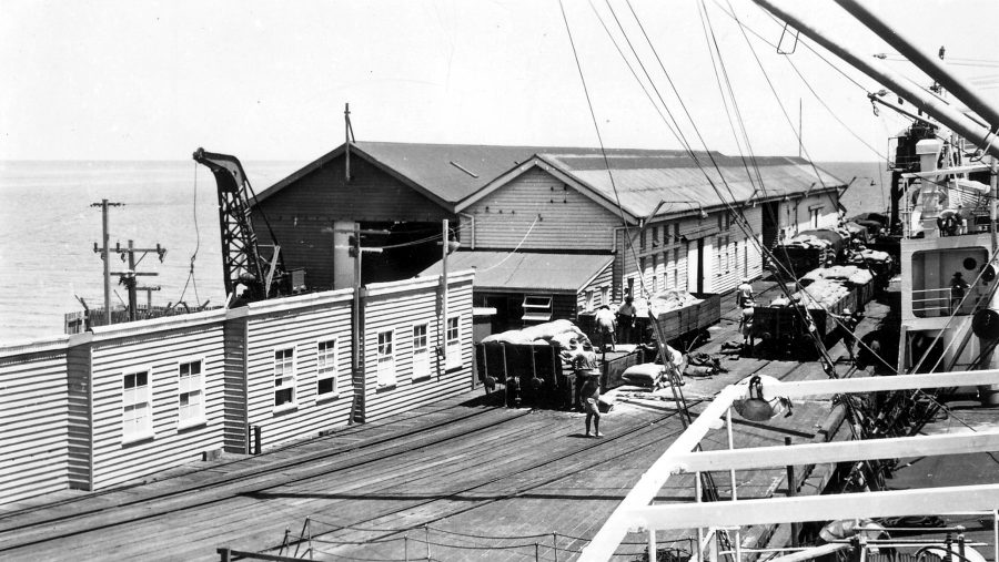
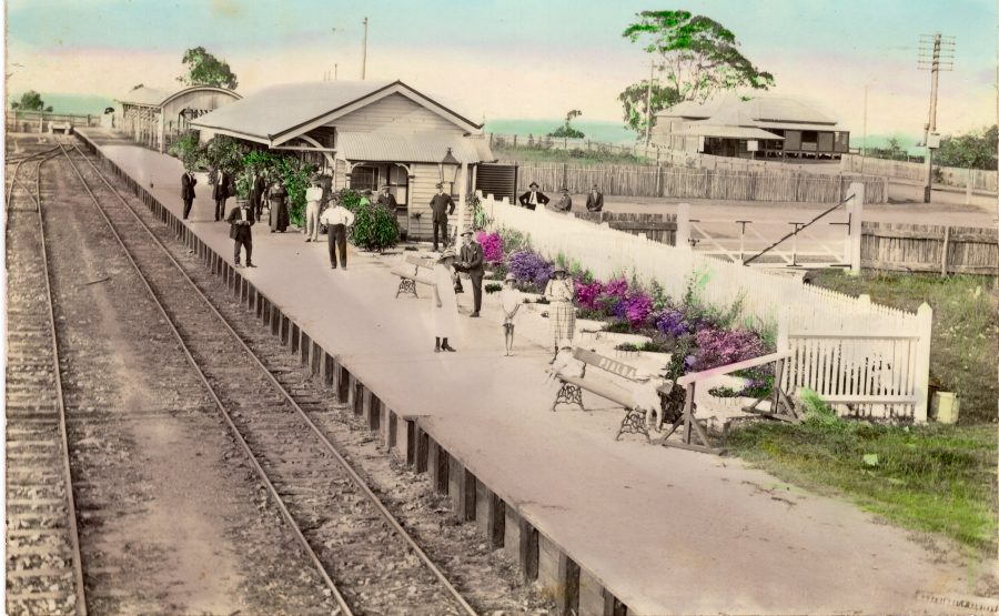
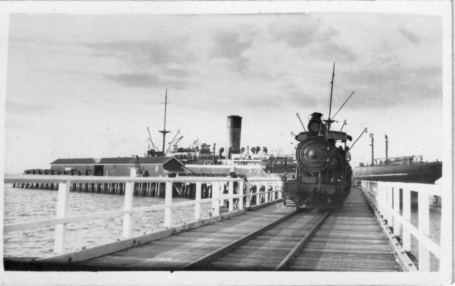
A railway line from Maryborough to Pialba was built in 1896, substantially boosting visitors and sightseers to the bay. The construction of Urangan Pier in 1913 and the extension of the railway line to serve the pier, greatly facilitated the export of sugar and coal to overseas ports.
Urangan developed as a settlement for fishermen during this period, while Torquay and Scarness evolved as tourist areas. Pialba became a commercial hub and Point Vernon emerged as the prime residential area with Esplanade home sites commanding views from Pialba to Urangan Pier.
By the 1920s Hervey Bay’s local industries included sugar cane, citrus and pineapple plantations, cattle and fishing. The growing popularity of the bay as a holiday destination was recognised even at this point in time.
A 1964 land use survey shows residential and commercial development hugging the beach from Gataker’s Bay at Point Vernon to the Urangan site where a boat harbour was built in the 1960s. Over the years this evolved into the present impressive Urangan Boat Harbour.
The 1970s saw Hervey Bay enter a growth period matched by few other cities in Australia. The five resorts of Point Vernon, Pialba, Scarness, Torquay and Urangan were still separate towns. They were administered by the Burrum Shire Council which stretched from near Maryborough to Woodgate. By 1976 resident numbers were estimated at 9,100. A strenuous push by Hervey Bay businessmen and shire councillors convinced the State Government to gazette Hervey Bay Shire Council in 1976. Hervey Bay was proclaimed a City on 18th February 1984.